
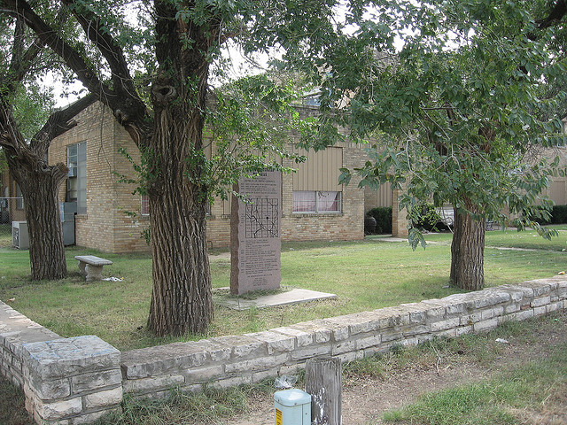
Martha Centennial Memorial
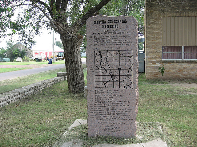
Martha Centennial Memorial
1896-1996 History of the Martha Community *
Location
Directions
Corner of Church and School Street. Martha, Oklahoma
Regions
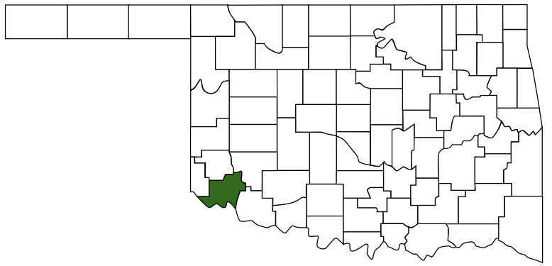 Jackson County
 Great Plains Country
 Oklahoma
Maps
- 34.725019, -99.384771
- OpenStreetMap
- Google Maps
- Bing Maps
- Apple Maps
- MapQuest
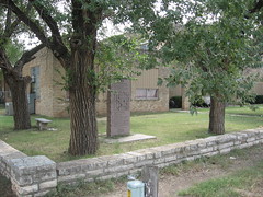
Pictures
Notes
More Pictures:
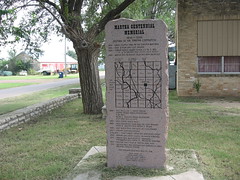
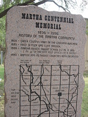
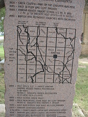
The full marker reads *:
The full marker reads *:
Martha Centennial MemorialLinks:
1896-1996 History of the Martha Community
1803 - Greer County - Part of the Louisiana Purchase
1885 - First Settler was Clint Maddox
1888 - Martha Medlin taught school 1/2 Mi N and 1/2 Mi W of present post office -- in a dugout
1889 - Baptist and Methodist churches both organized
(map)
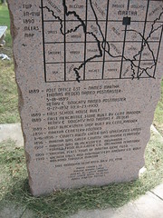
1889 - Post office est - named Martha Thomas Medlin named postmaster 5-18-1889 Henry C Doughty named postmaster 9-27-1892 to 11-21-1900
1889 - First school house built
1889 - First mercantile store built by Clint Maddox, Henry C Doughty and Thomas F Medlin
1889 - First blacksmith shop built by Clint Maddox
1891 - Martha cemetery founded
3-16-1896 - Courts ruled Greer was unassigend lands
1896 - Martha was Greer County Oklahoma Territory
1907 - Martha was in Jackson Co. Oklahoma
Formed from Old Greer Co Oklahoma Territory
1909 - Original plats town of Martha were filed
1910 - Wichita Falls and Northwestern Railway Co built railroad through Martha
This monolith dedicated July 20, 1996