
Old Greer County
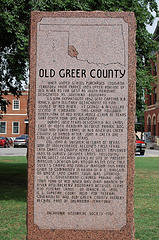
Old Greer County
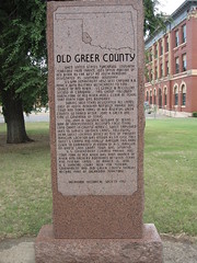
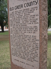
When the United States purchased Louisianna Territory from France, 1803, Upper portion of Red River as far west as 100th meridian designated as southern boundary.
US War Department, 1852, sent Captain R.B. Marcy with military detachment to find source of Red River. Lt. George B. McClellan, second in command. This group followed North Fork of Red River. Hence, calim of Texas that north fork was boundary.
During 1860, Texas designated all lands east of 100th meridian, between Praire Dog Town and North Forks of Red River as Greer County, so named after John A. Greer, One-time Lt. Govenor of Texas.
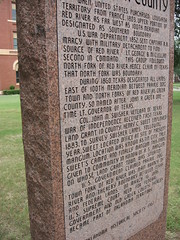
Col. John M. Swisher, vetern of Texas War of Independence, recieved first Texas land grant in county. Henry c. Sweet, employed 1883, to survey Swisher lands. Following year, Sweet located office at site of present Mangum. Location was known as Tin City. Then Sweet's campo and finally Mangum. This name given to the community in honor of A.S. Mangum on whose land grant town was situated.
U.S. Goverment claimed Prairie Dog Town fork of Red River was main branch of river and thereby boundary between Texas and Federal Lands, On March 16, 1896. U.S. Supreme Court held for Federal Goverment and Old Greer County thereby became part of Oklahoma Territory.
US War Department, 1852, sent Captain R.B. Marcy with military detachment to find source of Red River. Lt. George B. McClellan, second in command. This group followed North Fork of Red River. Hence, calim of Texas that north fork was boundary.
During 1860, Texas designated all lands east of 100th meridian, between Praire Dog Town and North Forks of Red River as Greer County, so named after John A. Greer, One-time Lt. Govenor of Texas.
Col. John M. Swisher, vetern of Texas War of Independence, recieved first Texas land grant in county. Henry c. Sweet, employed 1883, to survey Swisher lands. Following year, Sweet located office at site of present Mangum. Location was known as Tin City. Then Sweet's campo and finally Mangum. This name given to the community in honor of A.S. Mangum on whose land grant town was situated.
U.S. Goverment claimed Prairie Dog Town fork of Red River was main branch of river and thereby boundary between Texas and Federal Lands, On March 16, 1896. U.S. Supreme Court held for Federal Goverment and Old Greer County thereby became part of Oklahoma Territory.
Location
Directions
Found in the town square with Court House in Mangum, OK.
Regions
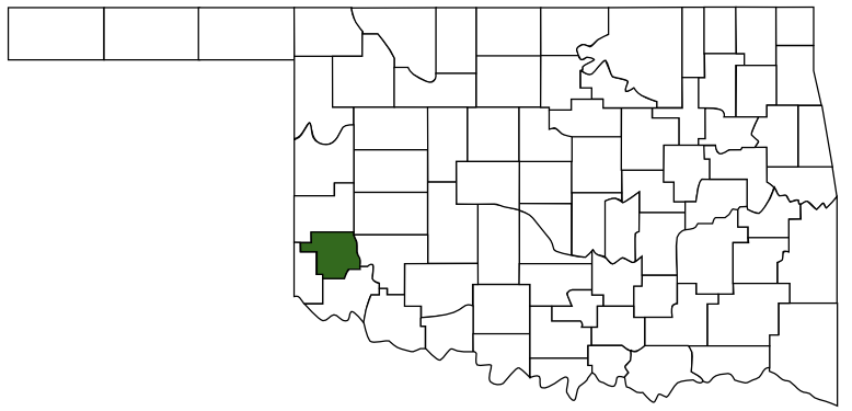 Greer County
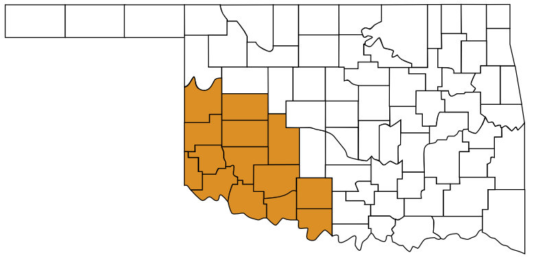 Great Plains Country
 Oklahoma
Maps
- 34.87251, -99.50597
- OpenStreetMap
- Google Maps
- Bing Maps
- Apple Maps
- MapQuest
Pictures
Notes
More Pictures:
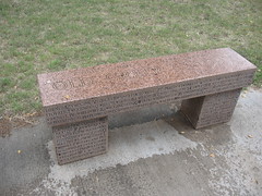
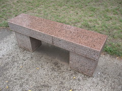
Benches In front of monument:
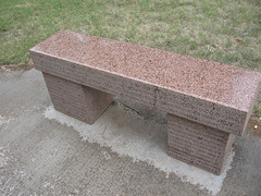
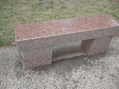
Benches In front of monument: