
Western Cattle Trail
Western Cattle Trail
Western Cattle Trail
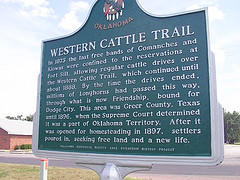
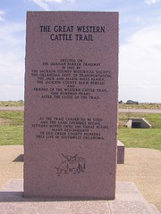
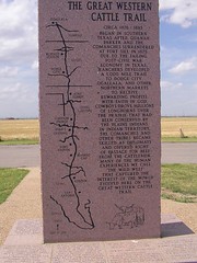
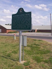
In 1875 the last free bands of Comanches and Kiowas were confined to the reservations at Fort Sill, allowing regular cattle drives over the Western Cattle Trail, which continued until about 1888. By the time the drives ended, millions of Longhorns had passed this way, through what is now Friendship, bound for Dodge City. This area was Greer County, Texas until 1896. when the Supreme Court determined it was a part of Oklahoma Territory. After it was opened for homesteading in 1897, settlers poured in, seeking free land a new life. Oklahoma Historical Society and Friendship History Project
In 1875 the last free bands of Comanches and Kiowas were confined to the reservations at Fort Sill, allowing regular cattle drives over the Western Cattle Trail, which continued until about 1888. By the time the drives ended, millions of Longhorns had passed this way, through what is now Friendship, bound for Dodge City. This area was Greer County, Texas until 1896. when the Supreme Court determined it was a part of Oklahoma Territory. After it was opened for homesteading in 1897, settlers poured in, seeking free land a new life. Oklahoma Historical Society and Friendship History Project
Location
Directions
East of Altus, Ok, Highway 62 turn north at mile marker 45, go to the town of Friendship. Marker is on the east side of road.
Other marker is East of Altus,Ok at the East end of Altus Air Force Base on Highway 62 monument is on the north side of highway in a scenic turn out.
Regions
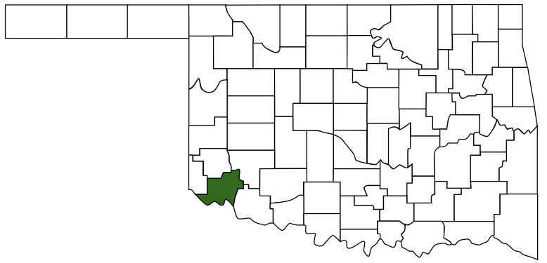 Jackson County
 Great Plains Country
 Oklahoma
Maps
- 34.69614, -99.22896
- OpenStreetMap
- Google Maps
- Bing Maps
- Apple Maps
- MapQuest
Pictures
Notes
More Pictures:
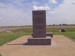
This Monument is located just out side of Altus Air Force Base.
Western Cattle Trail
Links:
www.rootsweb.com/~itgenweb/itprojects/roads/cattle-trails.htm
digital.library.okstate.edu/Chronicles/v014/v014p084.html
This Monument is located just out side of Altus Air Force Base.
Western Cattle Trail
Links:
www.rootsweb.com/~itgenweb/itprojects/roads/cattle-trails.htm
digital.library.okstate.edu/Chronicles/v014/v014p084.html