
Meers Store and Restaurant
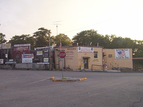
Meers Store and Restaurant
Meers Store and Restaurant
Est. 1901
"A Historic Dining Establishment"
On May 23, 1901, a group of miners met at the base of Mt. Sheridan, near where the present cedar grove is located, and organized a mining district. Out of respect for the first prospectors in the area, the miners named their camp Meers after Colonel Andrew Jackson Meers, who in 1989 found mineral rich quartzite outcroppings near the site.
The Meers Store is located on highway 115, 1 1/2 miles north of the Wichita Mountain Wildlife Refuge, where in 1927 the U.S. Forest Service gathered 20 cows and 3 bulls to save the Texas Longhorn from extinction.
Location
Directions
Take I-44 to Hwy 49. Travel West about 4 miles, to Hwy 58. Turn to the North for about 5 miles to the turn-off to Meers (follow the signs). Now turn to the West for 4 miles and you're there.
Regions
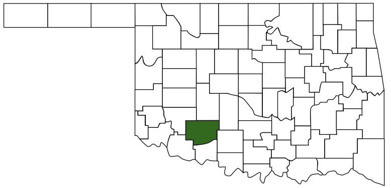 Comanche County
 Great Plains Country
 Oklahoma
Maps
- 34.78265, -98.57966
- OpenStreetMap
- Google Maps
- Bing Maps
- Apple Maps
- MapQuest
Pictures
Notes
National Register of Historic Places:
Meers Mining Camp (added 1978 - Building - #78002230)
Also known as Meers
20 mi. (32 km) NW of Lawton, Lawton
Historic Significance: Event
Area of Significance: Commerce, Social History
Period of Significance: 1900-1924
Owner: Private
Historic Function: Commerce/Trade
Historic Sub-function: Specialty Store
Current Function: Commerce/Trade
Current Sub-function: Department Store
More Pictures:
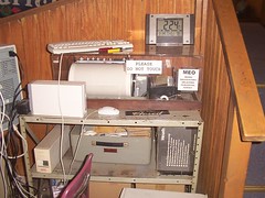
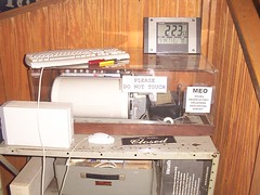
MEO Meers Observatory
Oklahoma Geological Survey
Meers, Oklahoma
In May of 1985, the Oklahoma Geological Survey installed a seismograph in the Meers Store to monitor the Meers Fault. The Meers Store became "MEO - Meers Observatory" and has proven to be one of the most sensitive stations in the country
Links:
http://www.meersstore.com/
http://www.meersstore.com/meo.html
Meers Mining Camp (added 1978 - Building - #78002230)
Also known as Meers
20 mi. (32 km) NW of Lawton, Lawton
Historic Significance: Event
Area of Significance: Commerce, Social History
Period of Significance: 1900-1924
Owner: Private
Historic Function: Commerce/Trade
Historic Sub-function: Specialty Store
Current Function: Commerce/Trade
Current Sub-function: Department Store
More Pictures:
MEO Meers Observatory
Oklahoma Geological Survey
Meers, Oklahoma
In May of 1985, the Oklahoma Geological Survey installed a seismograph in the Meers Store to monitor the Meers Fault. The Meers Store became "MEO - Meers Observatory" and has proven to be one of the most sensitive stations in the country
Links:
http://www.meersstore.com/
http://www.meersstore.com/meo.html