
Butterfield Overland Mail Rout
Butterfield Overland Mail Rout
The Butterfield Overland Mail, which operated from September 15, 1858, until March 1, 1861, was a semiweekly mail and passenger stage service from St. Louis, Missouri, and Memphis, Tennessee, across northern Texas to San Francisco, California.
Location
Directions
on US-271, south bank of Coal Creek, about 1/2 mile south of junction of US-271 and SHY31
Regions
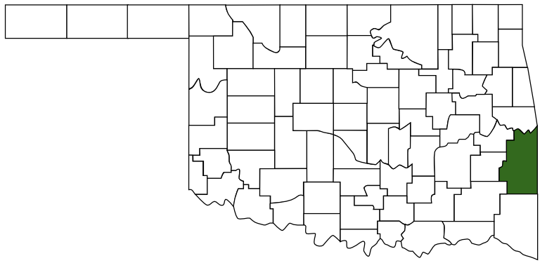 LeFlore County
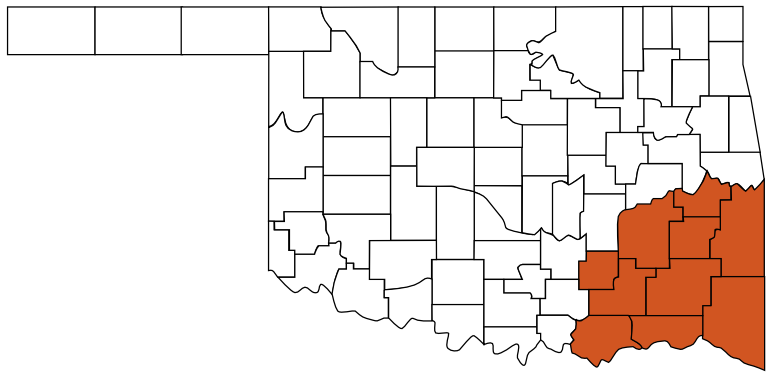 Choctaw Country
 Oklahoma
Maps
- No GPS Location Mapped
Pictures
Notes
Wikipedia
The Butterfield Overland Mail in Indian Territory was part of the Butterfield Overland Mail service (1857-1861) created by Congress March 3, 1857. In Indian Territory, the route crossed from Arkansas into the Choctaw Nation at Skullyville and left the Chickasaw Nation at Colbert's Ferry into Texas. There were twelve stage station in Indian Territory, located from thirteen to nineteen miles apart. The total length of the route across the territory was approximately 197 miles. The Butterfield route met with the Texas Road near Geary's Station and followed it southward to the Red River.Links:
Although it lasted only from 1857 to 1861, the Butterfield route made famous one of the most important roads in the settlement and development of early Oklahoma and was used until shortly before statehood in 1907. The route followed an old Indian trail out of the military's Fort Smith and was used by the Chickasaws during their settlement west in 1837. Following the Civil War, the Choctaw Council, to improve their economic interests, built bridges and turnpikes and maintained stage stands along their portion of the route.
Stations:
- Walker's Station - Located in what is now LeFlore County, it was named for Tandy Walker, a Choctaw chief.
- Trahern's Station - Located in what is now Leflore County, it was named for James N. Trahern, merchant and stage agent.
- Holloway's Station - Located in what is now Latimer County, it was named for the stage agent, William Holloway.
- Riddle's Station - Located in what is now Latimer County, it was named for trader, John Riddle.
- Pusley's Station - Located in what is now Latimer County, it was named for trader, Silas Pusley.
- Blackburn's Station - Located in what is now Pittsburg County, it was named for Casper B. Blackburn, local trader.
- Waddell's Station - Located in what is now Atoka County.
- Geary's Station - Located in what is now Atoka County, it was named for A.W. Geary, operator of the toll-bridge.
- Boggy Depot - Located on Boggy Creek in what is now Atoka County (in Boggy Depot State Park). It was named for the creek.
- Nail's Station - Located in what is now Bryan County, it was named for Joel H. Nail, the station operater.
- Fisher's Station - It was located in what is now Bryan County.
- Colbert's Station & Ferry - Located in what is now Bryan County, it was named for Benjamin F. Colbert, a prominent Chickasaw tribal leader and operator of the ferry. In addition, the ferry was important Red River crossing for the Texas Road and portal between the Indian Nations and Texas.
* Information from Oklahoma Historical Society