Expedition to Hollis
On Saturday, July 19th, Carleta (mom) and I decided to take a little trip down to Hollis, Oklahoma to grab some GPS readings for the courthouse and a few markers we had listed that way. Little did we know it would end up being a discovery expedition that would add several new historic places to our database.
Our fist stop on our trip was actually in Sayre, Oklahoma. Carleta wanted to get some pictures of the Beckham County courthouse for her own collection. She got a real kick out of Sayre's own Spirit of the Buffalo on the courthouse grounds.


Speaking of Sayre, there is supposed to be a marker somewhere west of town on old Route 66, but we haven't found it yet. If you have any ideas where it might be please post in our forum.
Since we were close by, our next stop was to Texola right of I-40 exit 1. We needed to get the GPS for the Will Rogers Highway marker on the state line. While in Texola we found a new historic place, Texola's Old City Jail. It's a small cement building no bigger than a modern day garden shed. You really wouldn't want to be locked up in there during the dead of winter or the high of summer.


Have you been to the new visitor center, east of Erick on I-40? It's nice, clean and friendly. We stopped in to look around, stretch our legs, and get some new maps and tourist brochures.


Next we swung through Erick getting some GPS readings for a few sites there including the Roger Miller Museum and the ever amusing Sandhills Curiosity Shop.


From there we journeyed down Highway 30 to Hollis. Now you would think along that route would be flat empty sagebrush scenery, but you would be wrong. It's actually a really nice scenic drive with short canyons and rolling hills. Well that is until you get closer to Hollis, then it becomes flat farm land again.
About 10 miles north of Hollis you'll find the Ron School monument. We stopped to get its GPS reading.


We got to Hollis, but not in time to visit the Harmon County museum. So we just took pictures of the mural painted on the side of the downtown museum.


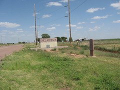
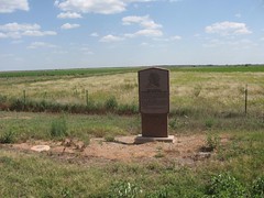
Hollis is only 5 miles from the Texas border, and Carleta wanted to see what the state line marker looked like. She's been on a kick to take pictures of Oklahoma shaped signs lately. What do we discover when we get to the state line? A new marker no one knew about. The 100th meridian Oklahoma/Texas state line marker is located in the no mans land between the Oklahoma and Texas state signs. At this point I remembered to use Utterz on this trip and made this post. Oh and the state line sign wasn't Oklahoma shaped.

After a short stop at the Harmon County courthouse (Utterz post), we were on our way to Altus. Just a few miles east of Hollis, we found another new marker, La Casa schools. (Utterz post)

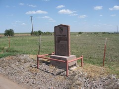
After a nice dinner at the Altus Applebee's, we journeyed north to see if we can get a picture of W.C. Austin Damn at Lake Altus, and to see if they ever put back up the Chief Bugler's Grave marker at the lodge. (They didn't) The lake was fairly crowed with weekend visitors, so we couldn't quite get to the damn. We did manage to get one shot of the dame between the Lugert and W.C. Austin markers (Utterz post).


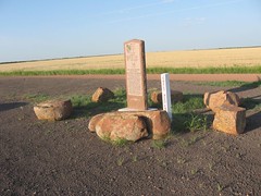
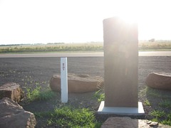
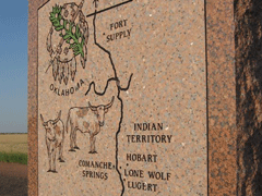
Instead of heading home like we planed we figured we'd visit Hobart before the sun went down. It was a good thing we did because we found a brand new marker a few miles south of Lone Wolf. The Great Western Cattle Trail Southwest Oklahoma was put in just last year. (Utterz post). What a find!
If you are in to really interesting looking old building, you should visit the Kiowa County courthouse. This red brick building is really something to see in the orange glow of sundown.
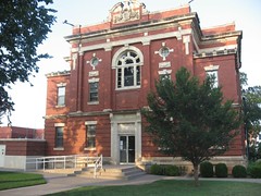
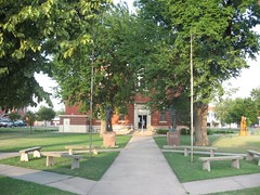

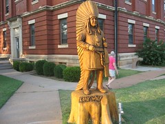
Other points of interest on the courthouse square are a large tile mosaic depicting the history of Kiowa, county, a chainsaw carved Lone Wolf sculpture, and few other monuments and statues.
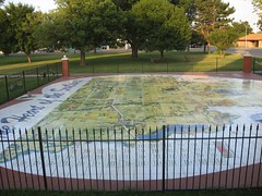

I think we'll need to revisit Hobart sometime when we have more time to look around. The Kiowa county museum grounds looked real interesting, and that tile mosaic is worth a second more detailed look.


It was a fun trip through southwest Oklahoma. We'll have to have another trip like this again soon.
Google Map of our Trip
Our fist stop on our trip was actually in Sayre, Oklahoma. Carleta wanted to get some pictures of the Beckham County courthouse for her own collection. She got a real kick out of Sayre's own Spirit of the Buffalo on the courthouse grounds.


Speaking of Sayre, there is supposed to be a marker somewhere west of town on old Route 66, but we haven't found it yet. If you have any ideas where it might be please post in our forum.
Since we were close by, our next stop was to Texola right of I-40 exit 1. We needed to get the GPS for the Will Rogers Highway marker on the state line. While in Texola we found a new historic place, Texola's Old City Jail. It's a small cement building no bigger than a modern day garden shed. You really wouldn't want to be locked up in there during the dead of winter or the high of summer.


Have you been to the new visitor center, east of Erick on I-40? It's nice, clean and friendly. We stopped in to look around, stretch our legs, and get some new maps and tourist brochures.


Next we swung through Erick getting some GPS readings for a few sites there including the Roger Miller Museum and the ever amusing Sandhills Curiosity Shop.


From there we journeyed down Highway 30 to Hollis. Now you would think along that route would be flat empty sagebrush scenery, but you would be wrong. It's actually a really nice scenic drive with short canyons and rolling hills. Well that is until you get closer to Hollis, then it becomes flat farm land again.
About 10 miles north of Hollis you'll find the Ron School monument. We stopped to get its GPS reading.


We got to Hollis, but not in time to visit the Harmon County museum. So we just took pictures of the mural painted on the side of the downtown museum.


Hollis is only 5 miles from the Texas border, and Carleta wanted to see what the state line marker looked like. She's been on a kick to take pictures of Oklahoma shaped signs lately. What do we discover when we get to the state line? A new marker no one knew about. The 100th meridian Oklahoma/Texas state line marker is located in the no mans land between the Oklahoma and Texas state signs. At this point I remembered to use Utterz on this trip and made this post. Oh and the state line sign wasn't Oklahoma shaped.


After a short stop at the Harmon County courthouse (Utterz post), we were on our way to Altus. Just a few miles east of Hollis, we found another new marker, La Casa schools. (Utterz post)


After a nice dinner at the Altus Applebee's, we journeyed north to see if we can get a picture of W.C. Austin Damn at Lake Altus, and to see if they ever put back up the Chief Bugler's Grave marker at the lodge. (They didn't) The lake was fairly crowed with weekend visitors, so we couldn't quite get to the damn. We did manage to get one shot of the dame between the Lugert and W.C. Austin markers (Utterz post).


Instead of heading home like we planed we figured we'd visit Hobart before the sun went down. It was a good thing we did because we found a brand new marker a few miles south of Lone Wolf. The Great Western Cattle Trail Southwest Oklahoma was put in just last year. (Utterz post). What a find!


If you are in to really interesting looking old building, you should visit the Kiowa County courthouse. This red brick building is really something to see in the orange glow of sundown.


Other points of interest on the courthouse square are a large tile mosaic depicting the history of Kiowa, county, a chainsaw carved Lone Wolf sculpture, and few other monuments and statues.


I think we'll need to revisit Hobart sometime when we have more time to look around. The Kiowa county museum grounds looked real interesting, and that tile mosaic is worth a second more detailed look.


It was a fun trip through southwest Oklahoma. We'll have to have another trip like this again soon.
Google Map of our Trip
View Larger Map
